UN
16 Southport Road
£ 63,500
Description
We don't have a Description for this property.
- Bedrooms
- 3
- Bathrooms
- 0
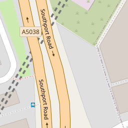


Leaflet © OpenStreetMap contributors
The heatmap indicates the level of crime in the area. The color of the heatmap indicates the crime severity and recency.
Metrics Year-on-Year
- Average area value
- 219,135.00 £Increased by 22.32 %
- Average area rental value
- 738.00 £/moIncreased by 26.15 %
- Est rental Yield
- 4.04 %Increased by 3.06 %
- Crime Rate
- 4.00 %Unchanged by 0.00 %
from 179,142.00 £
from 585.00 £/mo
from 3.92 %
from 4.00 %
Nearby Schools
| Name | Type | Ofsted | Distance |
|---|---|---|---|
| Hillside High School | Academy Sponsor Led | Requires improvement | 0.39 KM |
| Cambridge Children'S Centre | Children's Centre | 0.43 KM | |
| St Francis De Sales Catholic Junior School | Voluntary Aided School | Outstanding | 0.45 KM |
| Bedford Primary School | Community School | Good | 0.48 KM |
| St Francis De Sales Catholic Infant And Nursery School | Voluntary Aided School | Outstanding | 0.49 KM |
Images
Nearby Streets
| Name | Average Price | Average Sqft | Distance |
|---|---|---|---|
| Cassio Street | £ 0 | 0 | 0.00 KM |
| Fernhill Mews East | £ 250,000 | 0 | 0.00 KM |
| Cromwell Road | £ 75,000 | 0 | 0.00 KM |
| Hatfield Road | £ 0 | 0 | 0.00 KM |
| Carisbrooke Road | £ 160,000 | 0 | 0.00 KM |
Nearby Transport
| Name | NLC | TLC | Distance |
|---|---|---|---|
| Kirkdale | 2245 | KKD | 0.70 KM |
| Bank Hall | 2238 | BAH | 1.49 KM |
| Walton (Merseyside) | 2251 | WAO | 1.70 KM |
| Rice Lane | 2131 | RIL | 2.10 KM |
| Bootle Oriel Road | 2239 | BOT | 2.13 KM |
Nearby Listings
| Address | Price | Type | Score | Distance |
|---|---|---|---|---|
| Southport Road, Bootle | £ 240,000 | BUY | 6 / 10 | 0.17 KM |
| Hillside Close, Bootle | £ 210,000 | BUY | 6 / 10 | 0.17 KM |
| Hillside Close, Bootle, L20 | £ 220,000 | BUY | 8 / 10 | 0.17 KM |
| Carisbrooke Road, Bootle, L20 | £ 130,000 | BUY | 6 / 10 | 0.18 KM |
| Roxburgh Street, Bootle, Merseyside, L20 | £ 120,000 | BUY | Unknown | 0.19 KM |
Nearby Properties
| Address | Price | Distance |
|---|---|---|
| 16 Southport Road | £ 63,500 | 0.00 KM |
| 10 Southport Road | £ 77,500 | 0.00 KM |
| 14 Southport Road | £ 83,000 | 0.00 KM |
| 12 Southport Road | £ 110,000 | 0.00 KM |
| 9 Hillside Close | £ 119,000 | 0.16 KM |